EPA Maps Thousands of California Renewable Energy Sites
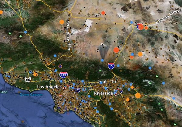
Google Earth screen capture of EPA's Renewable Energy Siting Tool
Renewable energy enthusiasts concerned about damage to habitat from renewable energy development have been saying for a few years that there's plenty of disturbed and damaged land on which we could be building our solar and wind facilities instead. And now, the U.S. Environmental Protection Agency (EPA) is backing them up.
The EPA, through its Repowering America's Lands initiative, has been diligently cataloguing parcels of land that are damaged, contaminated, or otherwise without much ecological value, but potentially suitable for renewable energy development. With help from the National Renewable Energy Laboratory (NREL), they've put their California sites database into map form as the just-launched Renewable Energy Siting Tool, with 11,000-plus sites listed in a map layer viewable with Google Earth.
Each of the sites listed can be clicked on in Google Earth to open a window with data on the size, ownership, and status of the land. Included are brownfields, superfund sites, closed mines, and other types of land that have been disturbed but are not currently in use.
Among the thousands of sites, some as small as an acre or two of urban vacant lot, are 75 places the EPA has determined to be "high priority" sites for development of utility-scale renewable energy including solar PV and concentrating solar, wind, geothermal, and small-scale hydro. 43 of the high-priority sites are suggested for utility-scale PV, and an additional 21 -- several of them in or near Los Angeles -- for geothermal development. The EPA designates only one high-priority wind site, in the Angeles National Forest east of Sylmar.
"Solar, wind and geothermal power projects may be the best use for certain tracts of impaired lands," said Jared Blumenfeld, Administrator for EPA Region 9, in a press release today. "By finding these properties and putting them back into productive use, we can reduce our carbon footprint while meeting the state's energy needs."
ReWire is dedicated to covering renewable energy in California. Keep in touch by liking us on Facebook, and help shape our editorial direction by taking this quick survey here.